Spatibase at a glance
Descriptions, facts, logos and screenshots you can copy as they are. Writing about Spatibase or adding it to a list? Use these, and write to us if anything is missing.
Spatibase in a table
- Category
- Headless CMS for map projects (map content management)
- For
- Agencies, GIS studios and freelancers building map features for clients, and the client teams who keep the data up to date; in-house teams welcome
- Pricing
- Free for everyone during the public beta, on every plan
- Delivery formats
- JSON, GeoJSON, Mapbox Vector Tiles with TileJSON, OpenAPI 3.1
- Import
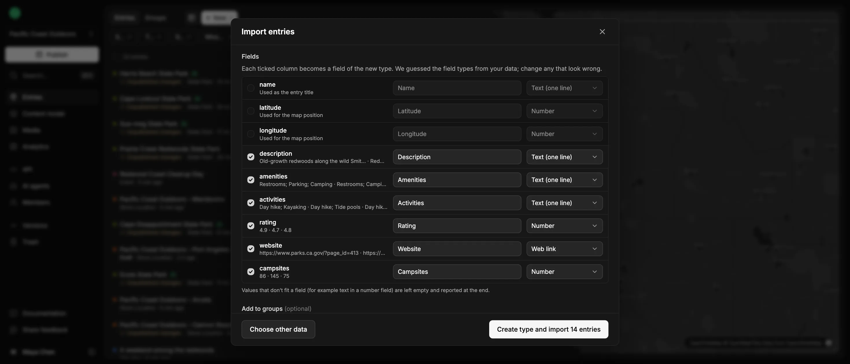
- CSV, Excel, GeoJSON, KML/KMZ, GPX, Shapefile, GeoParquet; Google Sheets, Google My Maps, PostGIS
- AI
- MCP server for Claude, ChatGPT, Cursor and custom agents, with keys or OAuth
- Works with
- MapLibre, Mapbox GL, Leaflet, QGIS and any app that reads JSON or GeoJSON
- Website
- https://spatibase.com
- Contact
- hello@spatibase.com
Copy these as they are
Three lengths, ready to paste into an article, a listing or a directory.
Spatibase is a headless CMS for map projects: agencies, GIS studios and freelancers build the map feature, a coding agent can do the setup, and the client’s team keeps places up to date in a simple map editor. Apps read the published content as JSON, GeoJSON and vector tiles.
Spatibase is a headless CMS for map projects. Agencies, GIS studios and freelancers build the map feature, and a coding agent can do the setup. The client’s team keeps points, routes and areas up to date in a simple map editor, with drafts and publishing. Apps read the published content through a cacheable API as JSON, GeoJSON and vector tiles, without a backend to build. AI assistants can also work on the data through an MCP server. In-house teams with the same need are welcome.
Spatibase is a headless CMS for map projects. Agencies, GIS studios and freelancers build the map feature, and a coding agent can do the setup. The client’s team keeps points, routes and areas up to date in a simple map editor, with drafts and publishing. Apps read the published content through a cacheable API as JSON, GeoJSON and vector tiles, without a backend to build. AI assistants can also work on the data through an MCP server. In-house teams with the same need are welcome. Teams define the kinds of places they map and the fields each one has, start from a spreadsheet, a map file, a Google My Maps map or a PostGIS table, or add entries from a phone in the field with Collect. Nothing reaches the API until someone publishes it. AI assistants such as Claude and ChatGPT can answer questions about published content or prepare drafts for review; publishing and deleting are separate permissions, off by default, and every change is in the activity log. Typical projects are store and location finders, tourism and trail maps, event maps, service areas, and campus and city maps.
What it does
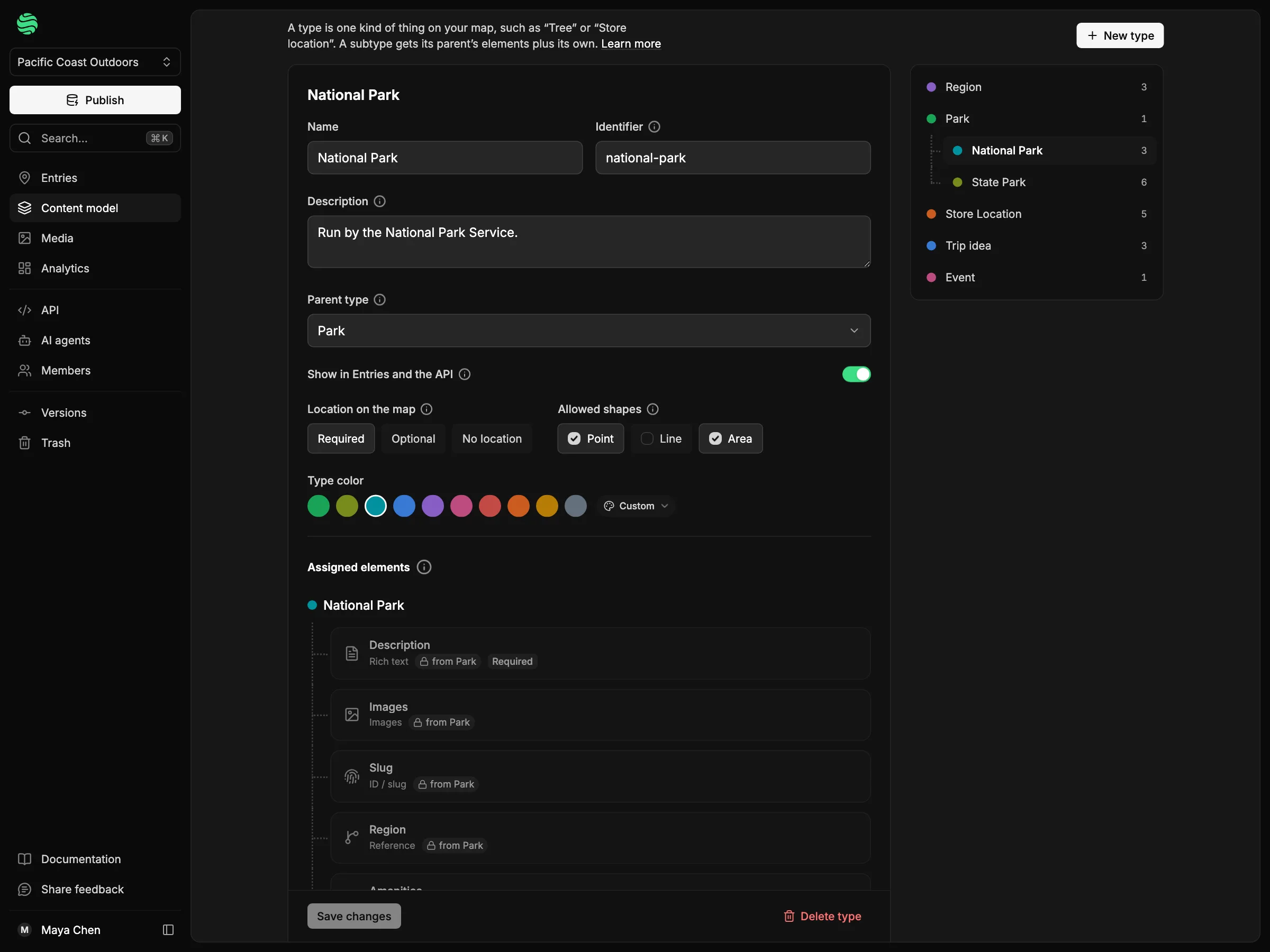
- Content model for places – Types with reusable fields (rich text, images, contact, references, map shapes and more); child types inherit their parent’s fields.
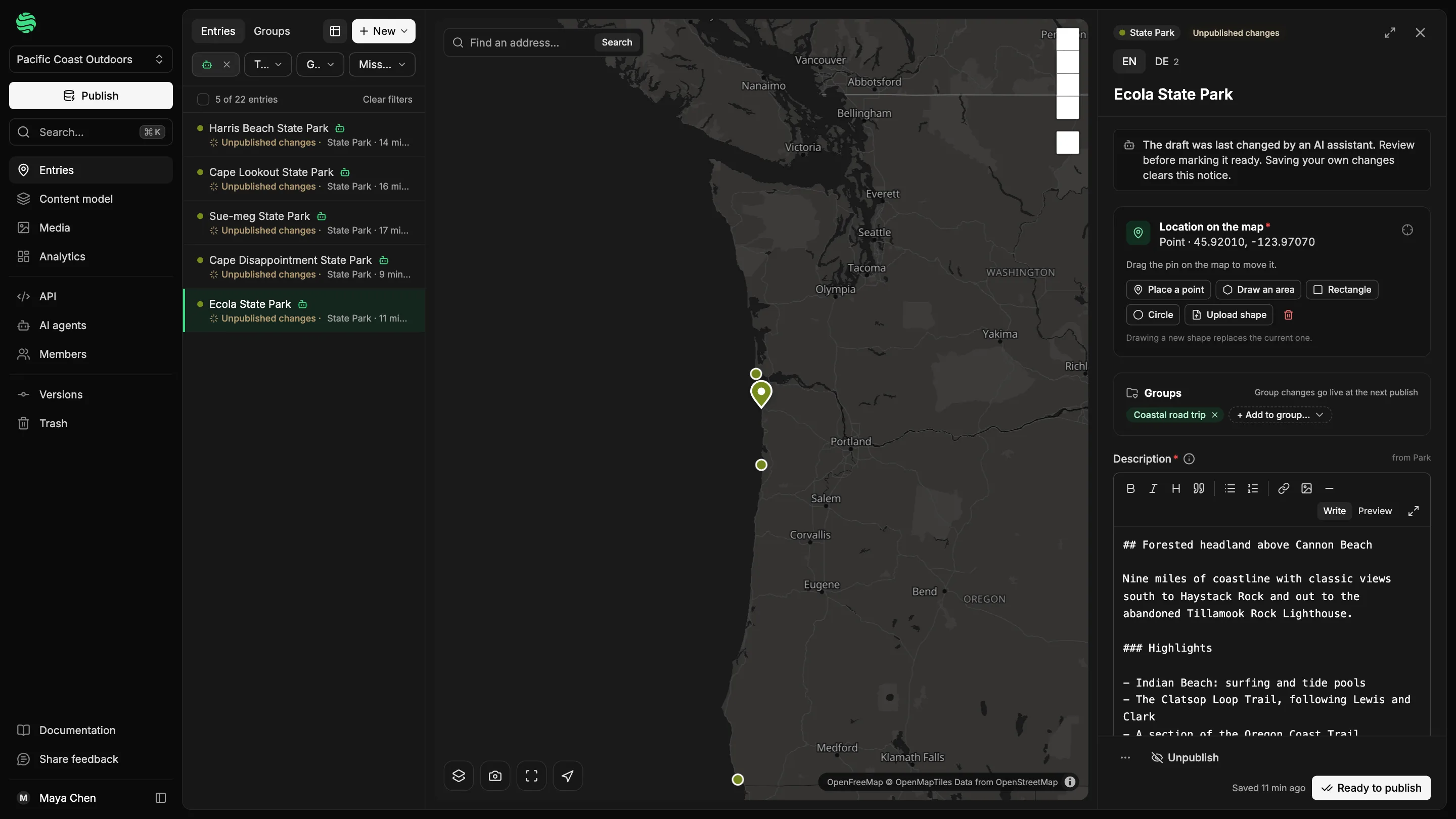
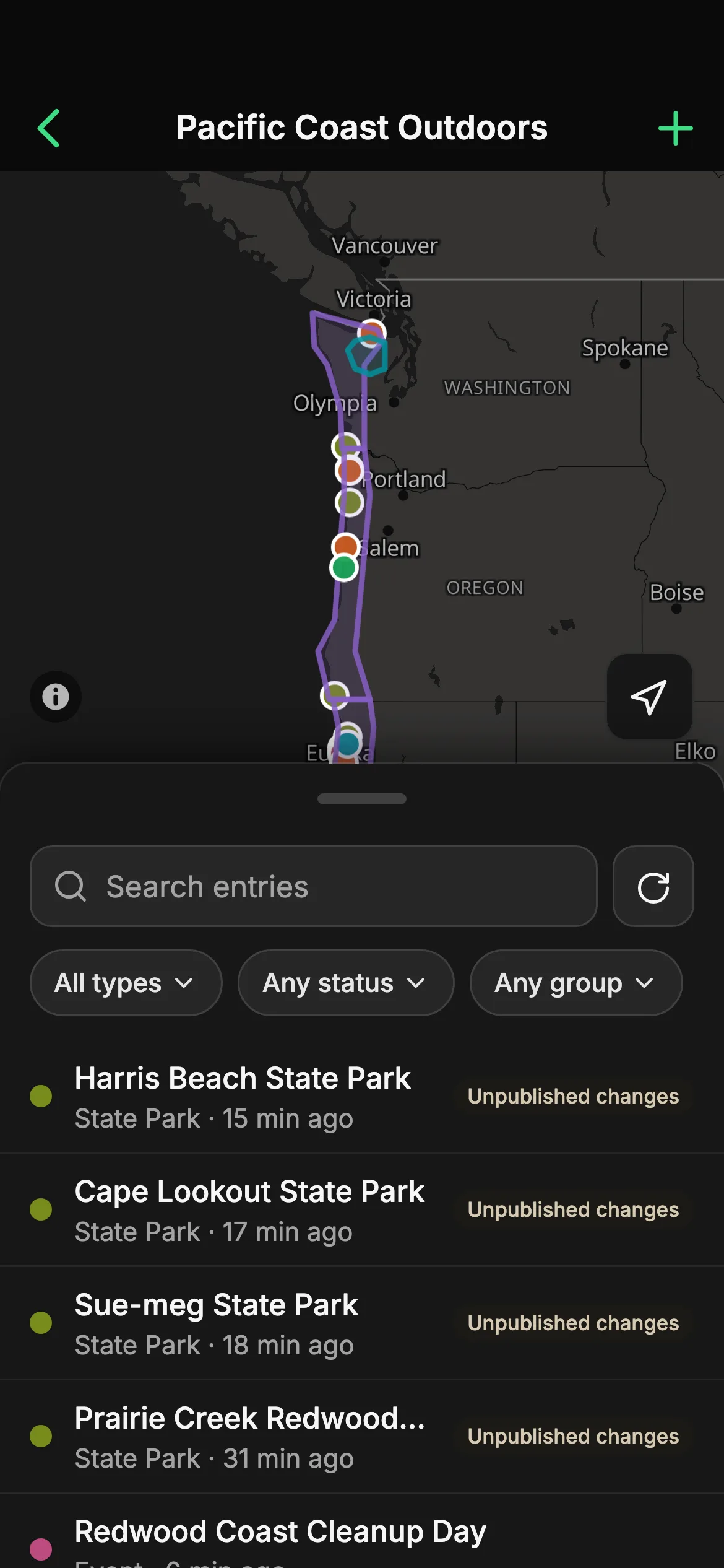
- Map editor with drafts – Editors draw, upload or import places on a map. Every change is a draft until someone publishes it.
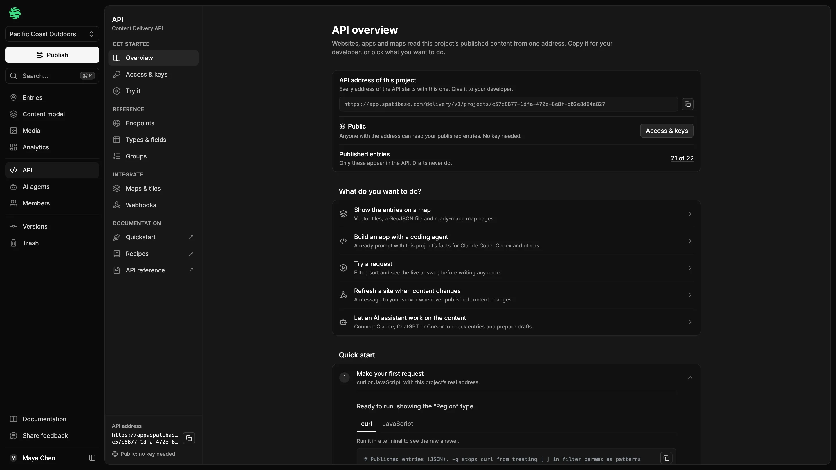
- Content Delivery API – A cacheable, read-only API with field filters, spatial queries, GeoJSON, vector tiles and image resizing; public, or private with API keys.
- AI assistants through MCP – Read keys answer questions; edit keys prepare drafts for review. Publishing and deleting are opt-in per key.
- Collect for field work – An installable phone and tablet web app to add entries with GPS locations and camera photos.
Logos and screenshots
Free to use when writing about Spatibase. Please don’t change the logo’s colours or proportions.


Something missing?
Write to hello@spatibase.com. A person on our team replies.