Changelog

What’s new

Everything we ship, newest first. Follow along with the RSS feed.

Finding your languages is quicker Improvement

Setting up translations takes fewer clicks now.

  • Search the lists. Type the English name, the language’s own name (Deutsch, čeština) or its code, and the exact code comes first.
  • Your language first. Default language starts on the one your browser uses, English otherwise.
  • A clear start. With languages off, the tab shows what they do and a Turn on languages button that asks for the default language in a small window.
New project opens where you are Improvement

A round of polish on New project after using it every day ourselves.

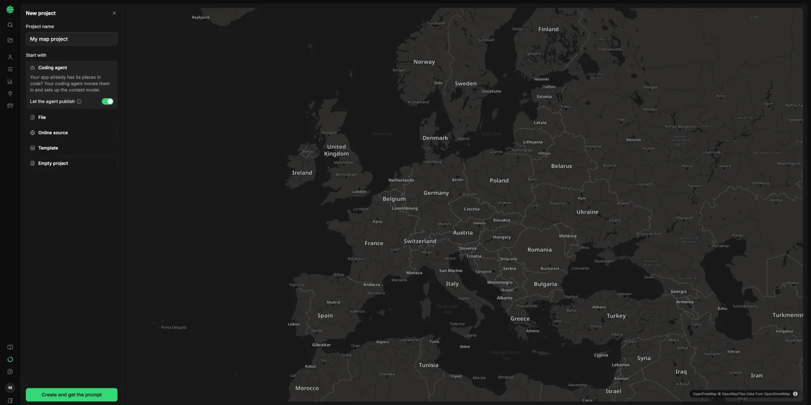
The New project screen in dark mode: the Start with list on the left with Coding agent chosen, and a dark map of Europe centred on Central Europe

  • Your area, not the whole world. The map opens around you, guessed from your time zone (or your location, if your browser already shares it). No prompt, nothing sent anywhere. A blank or coding agent project then opens on the same spot.
  • Maps follow your theme. New projects use the new Automatic map style: Streets in light mode, Dark in dark mode. Pick any other style and it sticks.
  • Coding agent comes first. It’s chosen when you open the screen, and in an empty project Use your coding agent opens a window with the prompt ready to copy.
  • Less to read. Sharing tips for Google Sheets, My Maps and PostGIS moved into the (i) next to each field.

Every publish is a version you can go back to New feature

Publishing now covers the whole project, and a bad publish can be undone.

  • Ready to publish. Edits stay drafts until someone marks them ready, so nobody ships a colleague’s or an AI assistant’s half-finished work by accident.
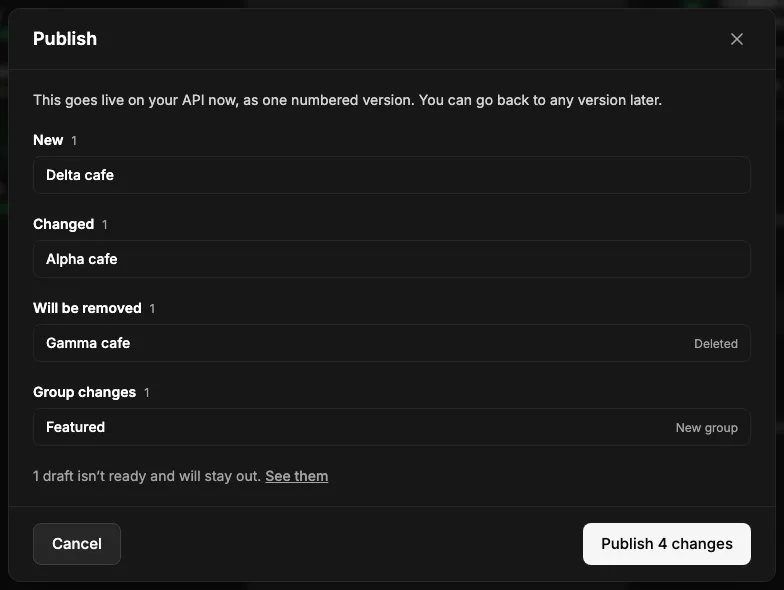
  • One Publish button. It shows exactly what goes live: new, changed and removed entries, plus group changes. Unpublishing and deleting wait for it too.
  • Versions. Each publish gets a number on the new Versions page. Open one to see what changed, or Go back to this version.
  • Restore one entry from its history into the draft.
  • AI assistants and the CLI follow the same steps: mark ready, then publish the project.

The Publish dialog listing a new entry, a changed one, one to be removed and a new group, with one draft that isn’t ready staying out

The spatibase command checks your import before it writes Improvement

We ran the spatibase command through a real project from a link code and smoothed every rough edge we hit.

  • Checked before anything is written. A wrong type, field, --match-by or language stops the import and names what does exist. Properties that would be dropped are listed.
  • --publish publishes only this run, never other drafts of the type.
  • Switched-off types are known. Coding agents that edit now see types you switched off in the app, so they import into them instead of calling them missing; verify lists them apart and import says they stay hidden until you switch them on.
  • Previews that work. model --preview and import --dry-run with images change nothing and report what would happen.
  • Two new commands. spatibase settings renames a project and adds languages without touching the default. spatibase tools lists what the key can do.
bash
spatibase settings --add-locale de
spatibase tools search_drafts

One converter for every map file New feature

One page now does every pair, instead of a page for each. Open the converter, or see all free tools.

  • Any direction: KML, KMZ, shapefile, GPX, GeoJSON or CSV, 30 pairs. Pick the format under Convert to and drop your file. It works out what it is, even a KMZ renamed to .zip.
  • Change your mind and the open file converts again, no second drop.
  • See it on a map first. Notes say what the new format can’t hold, like shortened shapefile fields, areas in a GPX or dropped styles.
  • Private: nothing leaves your computer.

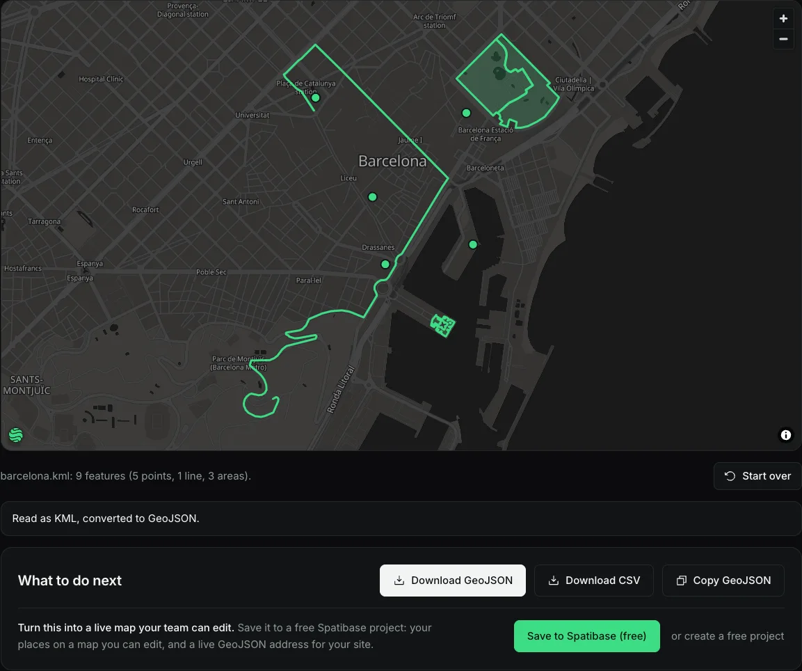
The converter with a KML file of Barcelona open: its places on a map, converted to GeoJSON, with download buttons

New project starts on the map Improvement

We wanted the shortest way from New project to a map you can put things on, so New project is now a screen with the map right beside it.

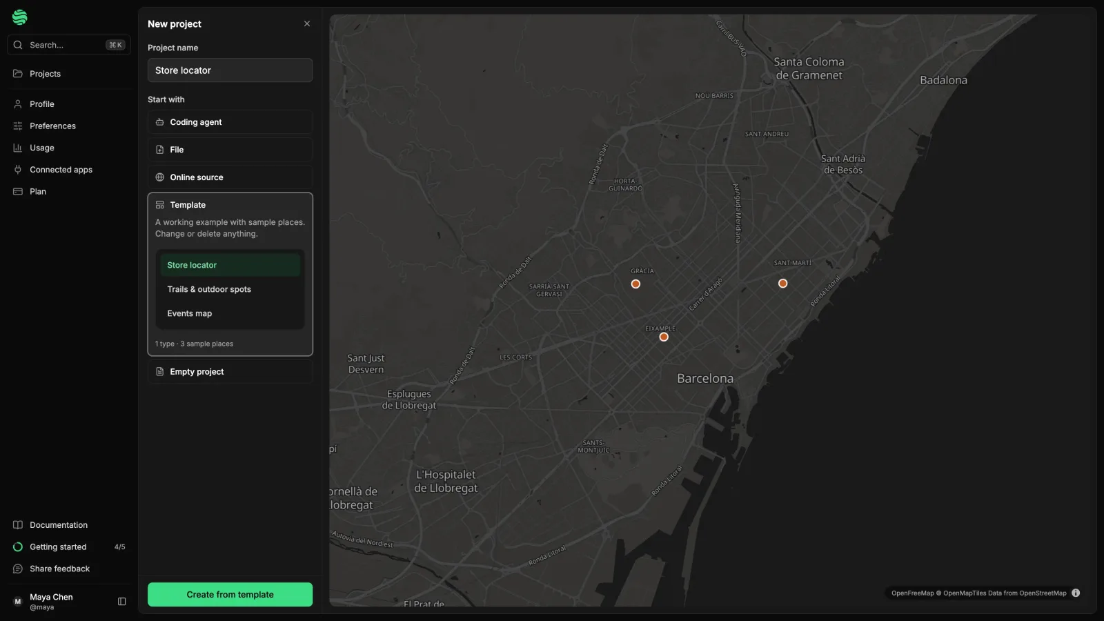
The New project screen in dark mode: the Start with list on the left with Store locator chosen, and its three sample stores as pins on a map of Barcelona

  • See a template first. Pick one and its sample places show on the map before anything is created.
  • No setup for an empty project. Click the map to add your first place. It gets a “Place” type by itself.
  • Fields as you go. Add field in the entry editor adds a description, photos, opening hours or your own field to every place. See your first map.
  • Leaving creates nothing. No stray “Untitled” projects.

Which zone is this point in, and what's closest New feature

Two questions map projects ask all the time now have their own answer in the API.

  • Which zone is this point in? contains=lng,lat returns the areas that cover the spot. Zones drawn in a field work too, see the delivery area check.
  • What’s closest? nearest=lng,lat lists places closest first with their distance, no radius needed. Ready for a store locator.
  • Faster near-a-point searches on large projects, thanks to a new index.
  • AI assistants can use the same filters through MCP.
http
GET /delivery/v1/projects/{id}/entries?contains=14.42,50.08
GET /delivery/v1/projects/{id}/entries?nearest=14.42,50.08&limit=5

Copy part of a public dataset, or let your AI assistant bring it in New feature

You no longer need a whole dataset when you only need your own country.

  • Copy part of a free dataset: pick a country, a region or an area on the map first, and only those entries come along. It also keeps a big dataset under the 10,000-entry limit for a copy.
  • AI assistants with an edit connection can list the datasets and import one, whole or filtered, into the project they work in. What assistants can do.
  • Everything arrives as drafts, so you decide what goes live, and the licence and credit travel with the data.

Start a project from the data you already have New feature

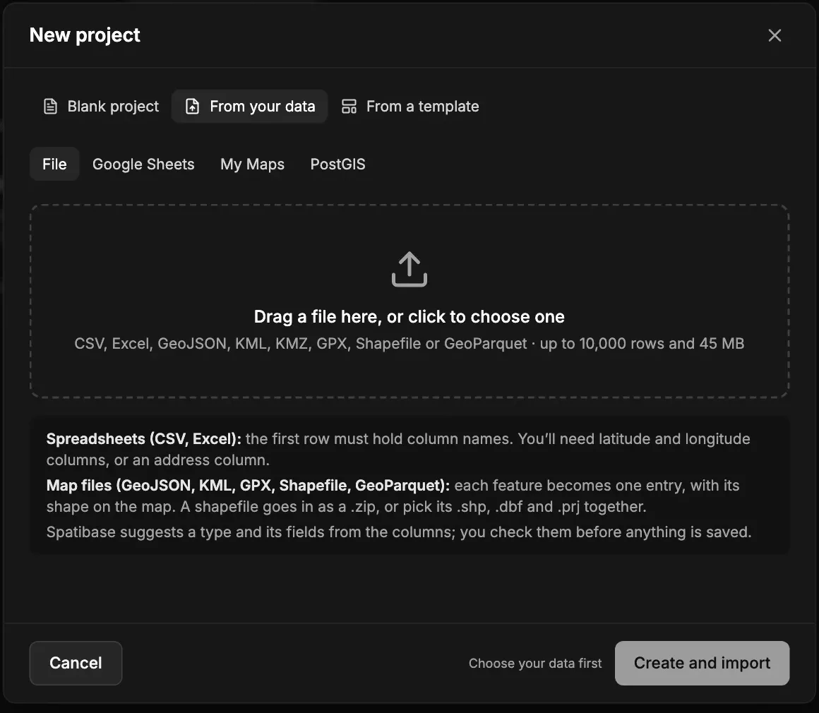
New project now has From your data, so moving a spreadsheet, map or database over isn’t a project of its own. See create a project.

  • A file: CSV, Excel, GeoJSON, KML, KMZ, GPX, Shapefile or GeoParquet.
  • A link to a Google Sheet or a Google My Maps map shared with anyone with the link. A My Maps map comes in whole, every layer, with the layer’s name kept so you can filter by it.
  • A PostGIS table: paste a connection string and choose one.
  • Then the project gets your data’s name, a suggested type and fields, and the rows once you’ve checked them. The same sources work in Import data… in any project.
  • Good to know: read once, not kept in sync, up to 10,000 rows at a time.

New project on From your data: a dropzone for files, with tabs for Google Sheets, My Maps and PostGIS

Scroll the list in Collect without the sheet jumping Fix

In Collect on a phone, scrolling the entries list used to grow or shrink the whole sheet.

  • The list and the entry form now simply scroll, at any height.
  • To resize the sheet, drag its top: the little handle and the search bar, or the entry’s top bar.
  • At half height you can scroll all the way to the last entry.

Delete your account yourself New feature

You can now delete your account under Settings → Profile → Delete account.

  • You see first which projects go with you, which you simply leave, and which you need to hand over because others work in them.
  • A code by email confirms it.
  • 30 days to change your mind: sign in and choose Keep my account. After that your projects and files are deleted, and in shared projects your name in the history becomes “Deleted user”.

Move your places behind an API with one prompt New feature

If your app keeps its places in a JSON file or a list in the code, your coding agent can move them for you.

  • One prompt from Start from your code, for Claude Code, Cursor or Codex. The agent shows a short report and waits for your OK.
  • Then it builds the types and fields, imports and publishes the places (photos and translations included), and points your app at the Delivery API.
  • No account needed: it works in a temporary project, and Keep my project in the email makes it yours at the same API address. Not kept? Deleted after a day, or three once an email was given.
  • Behind it is a small command-line tool, spatibase.

Your places in every language your app speaks New feature

Show every visitor your places in their language, without a field per language or a copy of every place. How translations work.

  • Languages live under Content model → Languages: pick a default, add others. Titles, texts and rich texts translate, choice options get a label per language, and the rest (location, links, opening dates) stays shared.
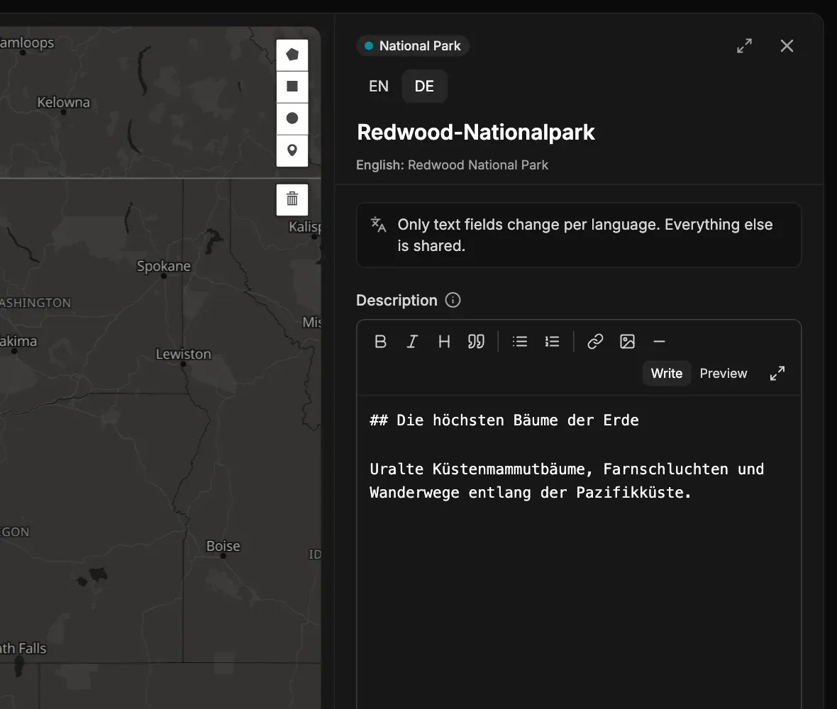
  • Language pills at the top of an entry switch languages, with the default text under each field.
  • The Missing filter shows what needs translating and hands you a prompt for your AI assistant to fill the gaps as drafts.
  • Apps ask with ?locale=de. Untranslated text falls back to the default, and the response says so.

An entry with the language pills EN and DE, translated into German with the default text beneath

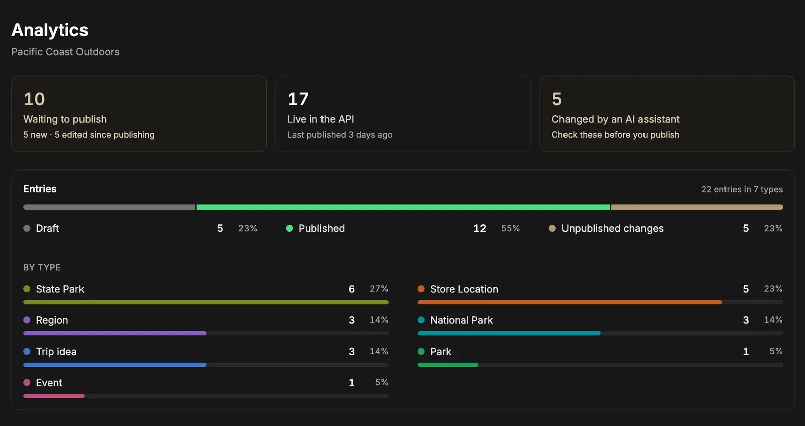
Analytics now shows what needs your attention Improvement

The top of the Analytics page now tells you something instead of listing counts.

  • Waiting to publish: how many entries, with a click straight to them.
  • Live in the API: how many, and when you last published.
  • AI assistant edits: a reminder to check them before they go live.
  • One card for entries by status and by type. Counts for types, fields, groups and files are still one click away in their own sections.

The Analytics page: waiting to publish, live in the API, changed by an AI assistant, and entries by status and type

Profile pictures and the logo look right in both themes Improvement

Two small touches so things stay easy to see in light and dark.

  • Profile pictures have a faint ring on the edge, so a white or very dark photo no longer melts into the page. In the app and in Collect.
  • The logo’s globe uses the same green as the page: deeper in light mode, bright mint in dark mode, in the app and on the website.

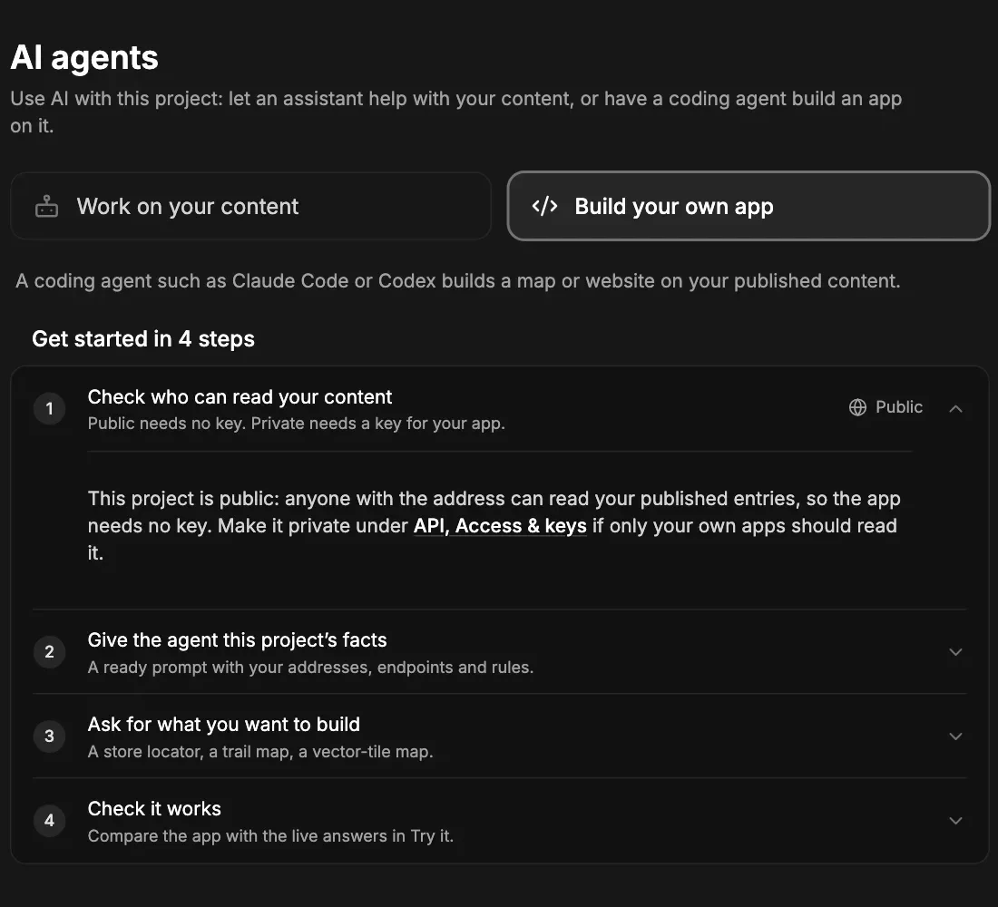
Build your own map app with a coding agent New feature

The AI agents page has a second path, for building your own map or website on your published content.

  • A ready prompt, filled in with your project’s real addresses, to paste into Claude Code, Codex or any coding agent.
  • A lighter page: each step opens when you need it.

The AI agents page with the Build your own app path and its four steps

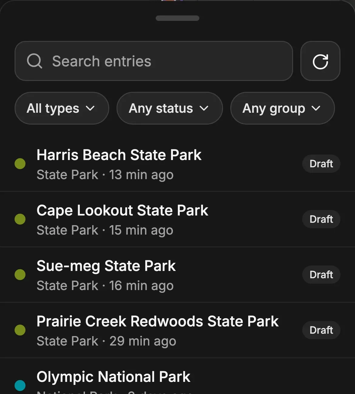
A calmer Collect that shows what is published Improvement

Collect on your phone now tells you only what needs you.

  • The list marks drafts and unpublished changes. Everything without a label is live.
  • Project cards show All published or Not all published, like on the computer.
  • Dark mode: fields are a step lighter, and the “Find an address” box lost its double outline.
  • Smaller things: map credits take less room, the installed app has a solid status bar, and an entry’s sheet no longer freezes mid-drag after saving.

Collect’s list of entries, with Draft marks only on entries that still need publishing

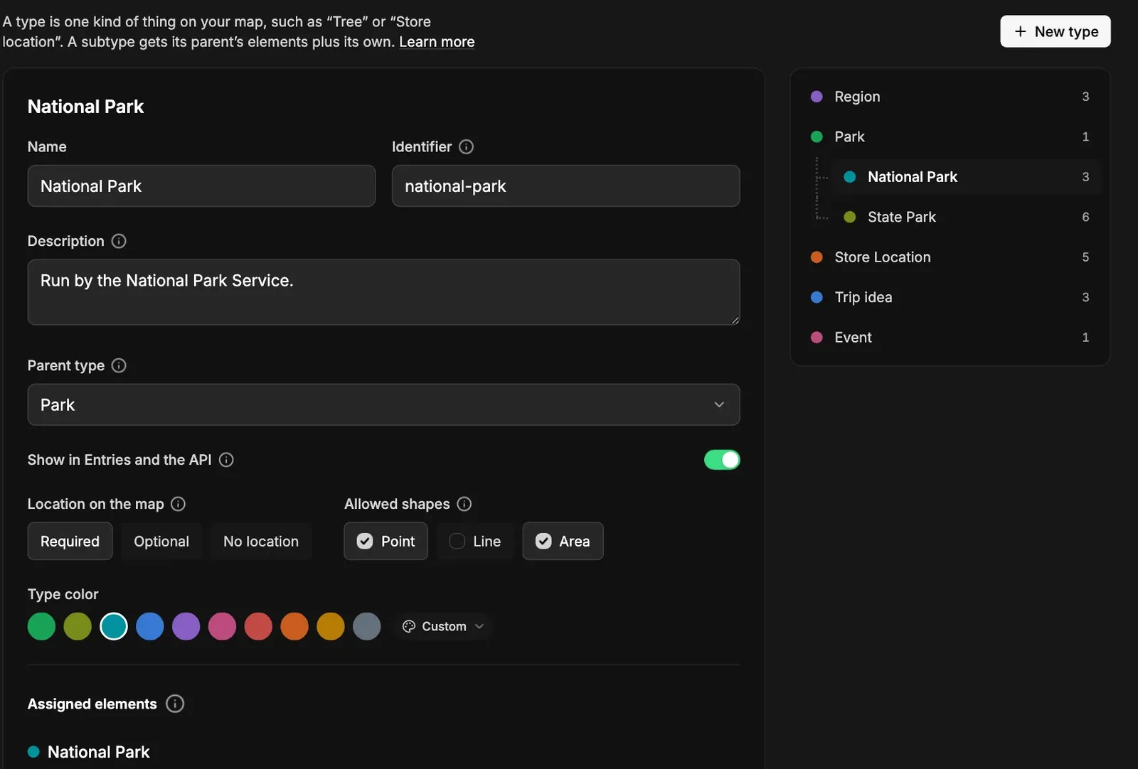
A calmer Content model and Media library Improvement

The Content model and Media library now look like the API and AI agents pages.

  • Soft grey panels for types, elements and map feature types, with the sliding switch between them.
  • The same switch for Media’s All, Images and Files.
  • Smaller, quieter buttons: New type, New element, New feature type and Upload files.
  • The API pages’ side menu blends into the page.

A type in the Content model: its settings, shapes and colour, next to the tree of types

Drop a shape file onto an entry Improvement

Got a route from a GPS watch or a boundary from a colleague? Drag the file onto Location on the map in the entry.

  • A dropzone shows up as soon as the file is over it. Let go, and the shape becomes the entry’s location.
  • GeoJSON, GPX or KML all work.
  • Upload shape is still there if you prefer picking the file.

Entries save as you type Improvement

Edit an entry and the change is saved to its draft on its own.

  • A few seconds after you stop typing or as you leave a field. There is no Save draft button any more.
  • No more “keep your changes?” when you move to another entry, close the panel or switch view. Publishing is still your call.
  • A value that can’t be saved, such as an identifier already in use: the rest is saved, the entry gets a mark in the list, and your typing waits for you.
  • History shows a short editing session as one change.

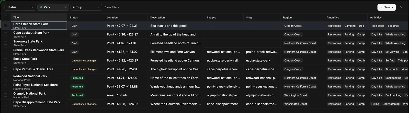
Edit your entries in a table, like a spreadsheet New feature

Fixing one field on 40 entries no longer means opening them one by one.

  • The Table button sits left of Entries | Groups. Pick a type and every field is a column you edit in its cell, saved by itself.
  • Spreadsheet keys: Tab, arrows and Enter, plus pasting a block from Excel or Google Sheets.
  • Fill, clear, add: select a range to fill down or clear it, type in the empty last row to add an entry, publish from the Status cell. Undo and redo step through your changes.
  • Not yet: it’s for computers, not phones, and shapes are still drawn on the map.

The Table view: entries as rows, every field a column, with status, location, region and choices

More in find, edit and export entries.

A steadier, quieter map Improvement

The map on Entries and everywhere else is calmer.

  • Folding the side menu moves only the menu. The map stays where it is and keeps drawing.
  • Zooming no longer flashes the old view, and zooming out fills unloaded edges with your map style’s colour, not a dark box.
  • Credits are the standard small ⓘ that opens a quiet strip, readable on light and dark styles. On large maps it starts open and folds when you drag.
  • The scale bar is gone. The credits are all still there, because the map data requires them.

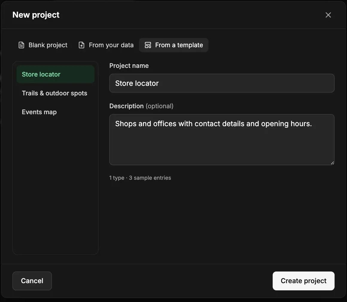
A clearer New project dialog Improvement

The New project dialog is wider and starts with a clear choice. See how to create a project.

  • Blank project, template or public dataset. Templates and datasets sit in a list on the left, and picking one fills in the name and description for you to change.
  • Your own description when you copy a public dataset, instead of the long source and licence text.
  • Fixed: Create from Blank or a template could stop with an error.

The New project dialog on From a template, with the templates listed on the left

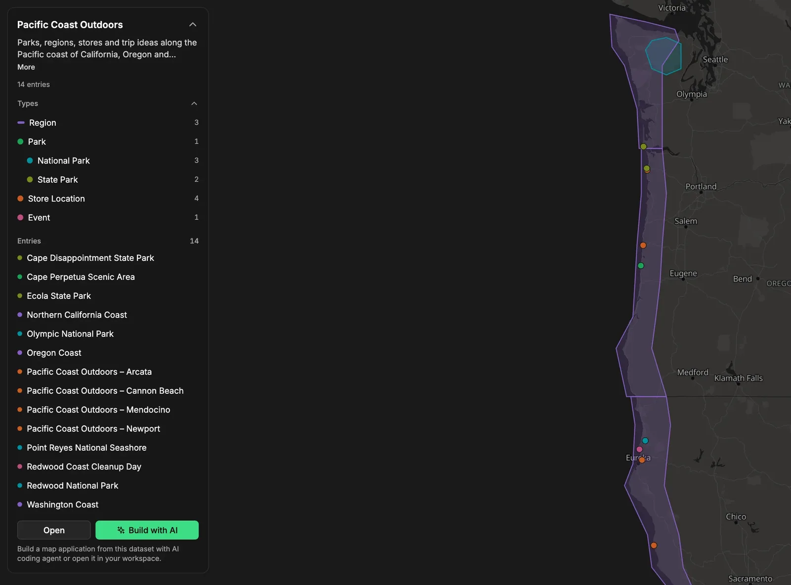
Preview your data on a public page New feature

Every public project has a preview page. Open it from the project menu with Preview data.

  • Your published entries on a map. Select one to see all its fields, formatted, with a button to copy its JSON.
  • A small panel lists your types and entries, so you can hide a type or jump to one entry.
  • Build with AI copies a ready prompt for a coding agent. Duplicate gives visitors their own copy of a public dataset.
  • The map stays with your data: move and zoom freely near your entries, and it stops a little past their edge.
  • A private project shows the preview only to its members.

The preview page: types and entries in a panel, published entries on the map

Try the demo projects.

Switching project keeps you in the same section Improvement

Jump to another project and you land on the same section, Analytics to Analytics.

  • Works for Analytics, Entries, Content model, Media, API, AI agents, Members, Activity and Trash, from the project menu or search (Cmd+K).
  • A clean start: filters and open entries of the old project don’t follow you over.

Ten more free converters New feature

The free converter list just got ten longer. KMZ to Shapefile and KMZ to GPX open a KMZ directly, so you don’t have to unzip it first, and GPX to KMZ packs a track into one small file you can open in Google Earth. We also added CSV to KML, KML to GeoJSON, GeoJSON to KML, GeoJSON to Shapefile, GeoJSON to CSV, GPX to GeoJSON and GPX to CSV.

We picked them after seeing which conversions people kept looking for. Like the other tools, they run in your browser, your file never leaves your computer, and every page has a sample you can try first.

See all free tools

Free airports dataset, and copy it into your own project New feature

Our first public dataset is out: 9,095 airports from OurAirports, with IATA and ICAO codes, type, elevation, country and region. It’s public domain, served from a public API with no key, filterable (try filter[iata_code]=PRG), and downloadable as CSV or GeoJSON.

The part I like most is Copy into your account. It puts the whole dataset into a new project of yours, already published, with its own API address. From there you can serve it as it is, or add what your app needs, like lounge info, photos or your own descriptions. Signed in already? You’ll find it under New project → Start from a public dataset.

Airports API and database | All datasets

Save to Spatibase, straight from the free tools New feature

Until now the free tools ended with “download the GeoJSON, then import it”. Now there’s a Save to Spatibase button instead. It opens Spatibase in a new tab and brings the file along, straight from your browser, so nothing is uploaded anywhere until you press Import. If you don’t have an account yet, you sign up first and the file waits for you in the same browser.

You land in a new project with the import already set up, the fields suggested from your file. One more click publishes it, and you get a live GeoJSON address to copy into your site or app. Signed in already? Pick which project it goes to.

Try it with the KML & KMZ viewer | How importing works

A bounding box finder that knows which order you need New feature

Every map library wants its bounding box in a slightly different order, and mixing them up puts your data in the ocean. The new bounding box finder lets you draw a box, use the current map view, search a place, or paste a box you already have in almost any format. It works out the order, and offers a swap when both readings make sense.

Then copy it the way your code expects: west, south, east, north, GeoJSON, WKT, Leaflet, MapLibre, OpenLayers (also in metres), Overpass, ogr2ogr or a Spatibase bbox= query. Boxes that cross the 180° meridian work too, and each format says how it handles them.

Open the bounding box finder | Filter entries by a box with the API

Free converters for KML, KMZ, GPX and shapefiles New feature

Eight new free tools, one for each pair of formats people kept asking about: KML to shapefile, shapefile to KML, shapefile to GeoJSON, GPX to KML, KML to GPX, KMZ to KML, KML to KMZ and KML to CSV. Drop a file, see it on a map, and download the converted file. Your file never leaves your computer.

We took care of the parts that usually go wrong. Shapefiles in a local grid like UTM are moved to longitude and latitude using their .prj, including older datums that other converters place a hundred metres off. A KML with points, lines and areas becomes a zip with one shapefile layer for each. Every page says what the conversion keeps and what it can’t carry over, such as styles or the time of each GPS point, so nothing gets lost without a note.

See all the converters

Map from Excel or CSV, and a CSV to GeoJSON converter New feature

Our second free tool. Drop a spreadsheet, an Excel .xlsx, CSV or TSV, and every row with a latitude and longitude shows up on a map. It reads European files too (semicolons, decimal commas like 41,3874), keeps numbers as numbers and postcodes like 08001 as they are, and tells you which rows it couldn’t place and why, so you can fix them in the sheet. Download the result as GeoJSON or KML for Google Earth. It reads columns the same way our import does, so a sheet that works here imports into Spatibase the same way.

Developers get the same engine on its own page, with the few lines of code to do it yourself. And every tool now has a “Download the sample” link next to “Open a sample”, so you can grab the exact file you just saw and try it in your own apps.

Make a map from Excel or CSV | CSV to GeoJSON converter

A free GeoJSON validator that fixes what it finds New feature

When a GeoJSON file won’t load, “invalid” isn’t much help. Paste it or drop the file, and the new validator lists every problem in plain words with its line number: an outline that isn’t closed, coordinates written as text, rings that run the wrong way round, a leftover crs. Most come with a one-click fix, or press Fix all, and the text is checked again after every fix, so what you download is what you see on the map.

It also tells you whether the file will import into Spatibase, using the same rules as the import itself, and which features would be skipped and why. If your points land on the wrong continent, Swap longitude and latitude puts them back. Your file stays in your browser.

Open the GeoJSON validator | Import GeoJSON into Spatibase

Draw a radius on a map New feature

Search for a place or click the map, set a distance, and the new radius map draws the area around it. The circles are true on the ground: every point of the edge is that distance from the centre, which is why big circles look stretched toward the poles. Add as many as you need (up to 50), name them, mix kilometres, miles and nautical miles, and drag a centre or the edge to adjust.

The whole map lives in the link, so Copy link is all it takes to share it, and you can download the circles as GeoJSON, KML or CSV. It’s straight-line distance, not travel time.

Open the radius map | Search near a point with the API

A free shapefile viewer New feature

Someone sends you a shapefile and you just want to know what’s in it. Now you can drop the zip, or the .shp, .dbf and .prj together, and see it on a map with every field in a table below. Click a shape to read its values. Nothing is uploaded, and there’s nothing to install.

For each layer, “About this file” says the shape type, how many features there are, which coordinate system the .prj names and that it was moved to longitude and latitude, the text encoding (so you know why names might look garbled), and each field’s type and size. You can save the data as GeoJSON, CSV or KML.

Open the shapefile viewer | Import it into Spatibase

Free KML & KMZ viewer New feature

Our first free tool. Drop a KML or KMZ file on the page and see its places, lines and areas on a map, with a list of every feature and its folder. Download it as GeoJSON or CSV (with latitude, longitude and WKT), copy the GeoJSON, or get the KML out of a KMZ. The file is read in your browser and never leaves your computer, and you don’t need an account. To keep the places in Spatibase, import the GeoJSON into a project.

Open the KML & KMZ viewer

OpenAPI 3.1 files for the Content Delivery API New feature

The Content Delivery API now describes itself. The generic OpenAPI 3.1 document is open without a key. Each project also has its own typed file, /delivery/v1/projects/<id>/openapi.json, that knows your types and fields, so a generated client autocompletes filter[rating][gte] and your field names. Both cover entries, GeoJSON, tiles, files and webhook messages, and import cleanly into Postman and Bruno.

Read about the OpenAPI files

Your own map style in the editor New feature

The map your editors work on can now look like the map your visitors see. Each project picks a basemap: Streets, Terrain, Light or Dark (with a Blueprint switch for a quieter look), or your own MapLibre style as a URL or JSON. On desktop, a “Show my location” button centres the map on where you are.

Choose a map style

Collect: add places from your phone New feature

Collect brings Spatibase to the field. Open it in the phone’s browser (or install it from there, no app store), pick a project, and add entries with your GPS position or a tap on the map, photos from the camera and the same fields as on desktop. The entry you’re working on stays on the device if the signal drops. It needs a connection to open; it isn’t a fully offline survey app.

See what Collect does | Collect in the docs

Create several fields at once Improvement

Setting up a content model is faster: the new element dialog groups the field kinds and lets you search them, keeps one draft per kind (a dot shows which are filled in and which need fixing), and creates every ticked one in list order.

Elements in the docs

Sign in with a 6-digit code Improvement

Every sign-in email now includes a 6-digit code next to the link. Type it into the sign-in page when the link would open in the wrong place, for example in an installed phone app that keeps its own cookies. The link and the code work once and expire after 15 minutes.

How sign-in works

Duplicate a project New feature

Start a new map from one you already have. Duplicating always copies the content model; you choose whether entries, groups, media files and the published state come along. Members, API keys, the webhook and AI assistant connections are not copied, and you become the copy’s owner.

How to duplicate a project

Start from a template New feature

A blank project is no longer the only way in. Pick the Store locator, Trails & outdoor spots or Events map template and you get a ready content model, sample places and a group, so you can see the editor and the API working in seconds and then replace the samples with your own data.

Start empty or from a template?

Talk to us

Not sure it’s a fit? Let’s find out

Tell us about your use case and what you need, from data model to security and deployment. In 30 minutes we’ll look at it together and tell you honestly if we can help.

Or write to hello@spatibase.com.